MapEngine
Internal tool for mapping and styling geospatial records
Settings
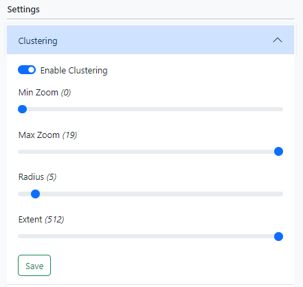
Clustering
Clustering is used to group nearby markers together.
|
|
Project
|
|
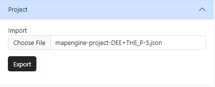
Exporting
Clicking the Export button will save your sources and layers to a file and download it to your device.
Importing
Clicking the Choose file button will prompt you to upload a MapEngine export file. The application will remove any existing data and rebuild the sources and layers (including their visibility, style, target filter, and relationships) contained in the export file.
Sources
Records
 |
Record source files are a JSON formatted array of objects with each object containing at minimum a |
Skyward typically exports data in CSV format, however there are many free online tools which can convert CSV files to JSON. The Technology Services department can perform bulk geocoding of addresses if needed.
| CSV | JSON |
|
|
GeoJSON
 |
A GeoJSON source is a file which defines geospatial features (e.g school boundaries) in the GeoJSON format. A repository of optimized SBLSD boundary files can be downloaded from github.com/sblsd/gis. |
Layers
Layers provide a way to style and organize the markers associated with source records. Markers can be targeted using attributes and values defined in the records.
Creating a Layer
To create a layer, click the New Layer button

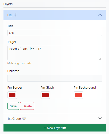
Editing a Layer
Title
The layer title can be any arbitrary string of text and is only used in the UI
Target
The layer target is a JavaScript expression which should evaluate to either true or false. Upon saving a layer, the target is evaluated against every source record in order to associate records with the layer.
The constant record is exposed to the target expression and can be used to filter records based on source data. For example, lets say this is what our source records look like (represented as a table to save space):
| School | Grade | Id |
| THE | 1 | 1 |
| THE | 1 | 2 |
| DEE | 2 | 3 |
| DEE | 3 | 4 |
| THE | 3 | 5 |
| DEE | 5 | 6 |
// Matches records where Grade is equal to 1. (2 records)
record['Grade'] == '1'

// Matches records where School is equal to THE. (3 records)
record['School'] == 'THE'

// Matches records where Grade is equal to 1, 2, or 3. (5 records)
['1','2','3'].includes(record['Grade'])

// Matches records where School is equal to LRE. (0 records)
record['School'] == 'LRE'
Children
Layers can nested by dragging and dropping them in to the parent layer's children container.
 |
Child layers:
|