| [](https://wiki.sumnersd.org/uploads/images/gallery/2023-11/B0VTUPtl71HDVT1E-image.png) |
| [](https://wiki.sumnersd.org/uploads/images/gallery/2023-11/7VncJ4lJ3UA6zf2n-image.png) |
| [](https://wiki.sumnersd.org/uploads/images/gallery/2023-11/eWNvkfdjULVuRzmi-image.png) | Record source files are a JSON formatted array of objects with each object containing at minimum a `lat` and `lng` key. Each record is attached to a marker which is placed on the map according to the latitude (`lat`) and longitude (`lng`) keys. Any other arbitrary properties and values can be included in each record. ```json [ { "First Name":"John", "Last Name":"Smith", ... "lat":"47.204935", "lng":"-122.237967" }, { "First Name":"Jane", "Last Name":"Doe", ... "lat":"47.204157", "lng":"-122.231124" } ] ``` |
| **CSV** | **JSON** |
| ```csv First Name,Last Name,lat,lng John,Smith,47.204935,-122.237967 Jane,Doe,47.204157,-122.231124 ``` | ```JSON [ { "First Name":"John", "Last Name":"Smith", "lat":"47.204935", "lng":"-122.237967" }, { "First Name":"Jane", "Last Name":"Doe", "lat":"47.204157", "lng":"-122.231124" } ] ``` |
| [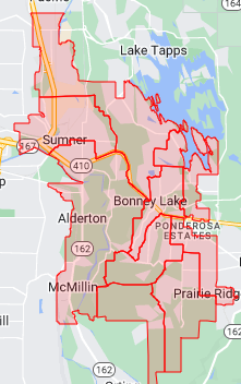](https://wiki.sumnersd.org/uploads/images/gallery/2023-11/NUn8zOrtOSddPnlf-image.png) | A GeoJSON source is a file which defines geospatial features (*e.g school boundaries*) in the [GeoJSON format](https://en.wikipedia.org/wiki/GeoJSON). A repository of optimized SBLSD boundary files can be downloaded from [github.com/sblsd/gis](https://github.com/sblsd/gis). |
| **School** | **Grade** | **Id** |
| THE | 1 | 1 |
| THE | 1 | 2 |
| DEE | 2 | 3 |
| DEE | 3 | 4 |
| THE | 3 | 5 |
| DEE | 5 | 6 |
| [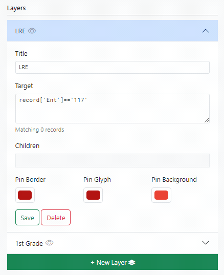](https://wiki.sumnersd.org/uploads/images/gallery/2023-11/6Noaqo5BKdWb4Lsk-mapengine-layer-child.gif) | Child layers: - Inherit their parent's style settings - Inherit their parent's visibility - Evaluate their target filter **only** against records that are also matched by their parent - Are deleted when their parent is deleted |